
2-Day Lassen Volcanic National Park Itinerary: Hikes, Lakes & Volcanic Stops
Affiliate & Information Disclosure: This blog is based on our personal visit and is intended for general travel-planning purposes. Trail conditions, road access, operating hours, fees, closures, and weather can change, so always verify current information on the official National Park Service website before your trip. This post may also contain affiliate links. If you purchase through one of these links, I may earn a small commission at no additional cost to you.
If you are planning a Northern California road trip, this Lassen Volcanic National Park itinerary is perfect for experiencing an incredible combination of volcanic landscapes, hydrothermal areas, alpine lakes, waterfalls, scenic drives, and hiking trails in two days. We recently visited Lassen from the Bay Area and were honestly surprised by how many completely different landscapes we could experience within the same national park.
One moment you are standing beside steaming mudpots at Sulphur Works, and a little later you can be looking across the deep blue water of Lake Helen, hiking through forests to mountain lakes, relaxing beside Manzanita Lake, or walking through the enormous hydrothermal basin at Bumpass Hell. Lassen is also geologically fascinating because the park contains examples of the four primary types of volcanoes: shield, composite, cinder cone, and plug dome.
In this blog, I am sharing the route we actually followed during our two-day trip from the Bay Area, including our hikes, scenic stops, places where we slowed down and relaxed, practical tips we learned during the visit, and a few additional Lassen attractions we would consider for a future trip.
One especially important thing to know before visiting is that cellular service in Lassen Volcanic National Park is very limited and unreliable. We found it much better to prepare our trail information before entering the park. If you plan on hiking, I recommend checking your routes on AllTrails and downloading the trail maps in advance so you can still access the route even when you lose cell service inside the park. Having the trail information saved beforehand made planning our hikes much easier and gave us extra peace of mind while exploring.
- Lassen Volcanic National Park at a Glance
- Limited Cell Service in Lassen: Download Your Trail Maps Before You Go
- Our 2-Day Lassen Volcanic National Park Itinerary
- Day 1: Bay Area to Lassen – Hydrothermal Areas, Lakes & Waterfall Hikes
- 1. Drive From the Bay Area to Red Bluff
- 2. Lassen Volcanic National Park Entrance Sign
- 3. Kohm Yah-mah-nee Visitor Center
- 4. Sulphur Works
- 5. Emerald Lake
- 6. Lake Helen
- 7. Terrace Lake & Shadow Lake Hike
- 8. Devastated Area Interpretive Trail
- 9. Relax at Manzanita Lake
- 10. Kings Creek Falls – Our Final Hike of Day 1
- Day 2: Subway Cave, Manzanita Lake, Summit Lake & Bumpass Hell
- 1. Subway Cave – A Lava Tube Near Lassen
- 2. Enter Through Lassen's Northwest Entrance
- 3. Lassen Peak Vista Point at Manzanita Lake
- 4. Loomis Museum
- 5. Manzanita Lake – Yes, We Came Back Again
- 6. Summit Lake Loop
- 7. Scenic Meadow & Volcanic Legacy Scenic Byway Views
- 8. Bumpass Hell – The Must-Do Lassen Experience
- Other Things to Do in Lassen Volcanic National Park
- What to Pack for Lassen Volcanic National Park
- Important Tips Before Visiting Lassen Volcanic National Park
- Is Two Days Enough for Lassen Volcanic National Park?
- Our Favorite Places in Lassen Volcanic National Park
- Final Thoughts on Our 2-Day Lassen Volcanic National Park Itinerary
Lassen Volcanic National Park at a Glance
Location: Northern California
Main Entrances: Southwest Entrance and Northwest/Manzanita Lake Entrance
Main Park Road: Approximately 30 miles through the park
Park Entry Reservation: Not required
Entrance Fee: A park entrance pass or qualifying federal recreation pass is required
National Park Pass & AllTrails Plus Bundle
Best Season for This Itinerary: Summer through early fall, when the main park road and seasonal hiking trails are accessibleCell Service: Very limited and unreliable inside the park
Our Recommended Time: At least 2 full days
The Lassen Volcanic National Park Highway connects the northwest entrance near Manzanita Lake with the southwest entrance. Driving the entire highway without stopping takes roughly an hour, but realistically you will want much longer because many of Lassen’s best lakes, viewpoints, hydrothermal features, and trailheads are located along this route.
Because Lassen receives significant winter snowfall, the highway and some high-elevation trails can remain inaccessible well into the warmer months. Always check Lassen Volcanic National Park’s official NPS website before leaving home.
Limited Cell Service in Lassen: Download Your Trail Maps Before You Go
This is one tip I would not skip. Cellular service is extremely limited throughout much of Lassen Volcanic National Park. Even if you normally depend on your phone for directions and trail information, you should prepare everything you need before entering the park.
For hiking, I like having AllTrails available so I can review the trail route, distance, elevation information, recent trail details, and map before starting. AllTrails Plus also allows maps to be downloaded for offline use and offers features such as wrong-turn alerts, which can be especially useful in an area where you cannot depend on having cellular service.
Planning more National Park trips?
AllTrails also offers a bundle combining AllTrails Plus with a National Park/Federal Recreation annual pass. If you are planning to visit multiple national parks, you can check the current bundle details.
Our 2-Day Lassen Volcanic National Park Itinerary
We approached the park differently on each day. On Day 1, we entered from the Southwest Entrance after driving from the Bay Area. On Day 2, we first explored Subway Cave outside the national park and then entered Lassen from the Northwest Entrance near Manzanita Lake. This worked well because it allowed us to experience both sides of the park instead of repeating exactly the same route.
Day 1: Bay Area to Lassen – Hydrothermal Areas, Lakes & Waterfall Hikes
1. Drive From the Bay Area to Red Bluff
We started our trip from San Jose at around 7:00 AM. If you are driving from elsewhere in the Bay Area, I recommend leaving early because Day 1 includes both the drive to Lassen and several park stops.
Our first proper stop was Red Bluff, where we refilled the gas tank and stopped at SIP Coffee Bar for coffee and breakfast. I would definitely recommend taking advantage of a stop like this before reaching Lassen. Although seasonal fuel may sometimes be available near Manzanita Lake, NPS recommends filling your tank before arriving because fuel availability inside the park is not guaranteed.
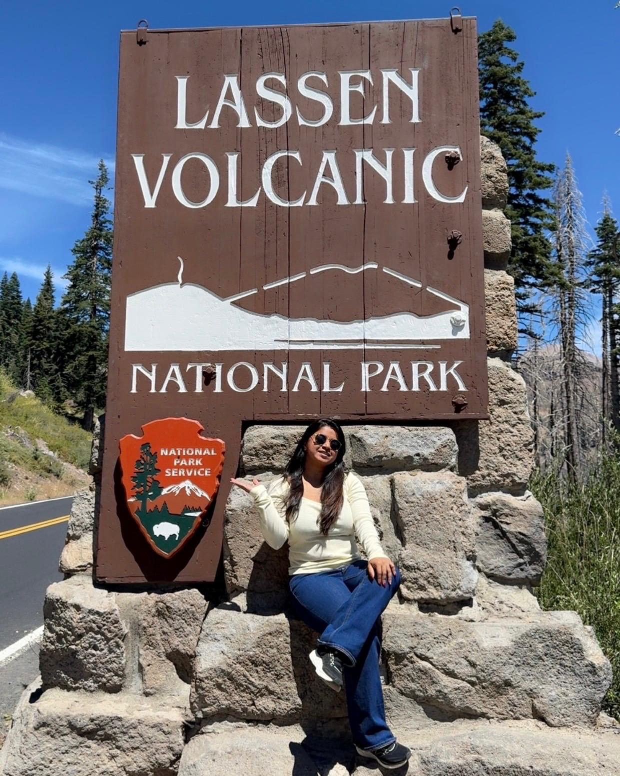
2. Lassen Volcanic National Park Entrance Sign
Before officially beginning our sightseeing, we made a quick stop at the Lassen Volcanic National Park entrance sign for photos. It only takes a few minutes, but we love keeping these classic national park sign pictures from our trips.
3. Kohm Yah-mah-nee Visitor Center
We entered Lassen through the Southwest Entrance and made the Kohm Yah-mah-nee Visitor Center our first official stop. I recommend doing the same, especially if this is your first visit.
We picked up a park map and spoke with the park rangers about trails and current conditions. Because snow, weather, maintenance, and wildfire impacts can change access within Lassen, a quick conversation with a ranger can help you make better decisions for the rest of your day.
4. Sulphur Works
Our first natural attraction was Sulphur Works, one of the easiest places in Lassen to see active hydrothermal features. It is located along the park highway and requires only a short paved walk from the parking area.
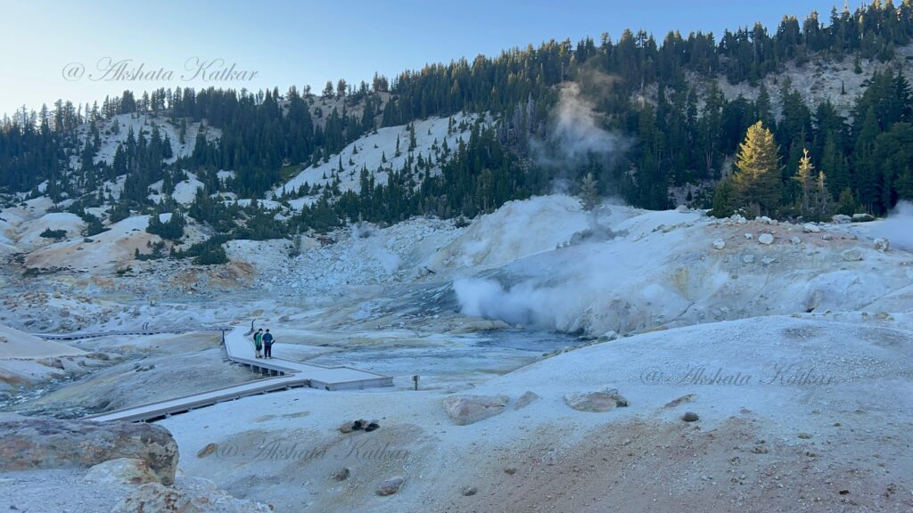
Here you can see steaming ground, bubbling mudpots, colorful mineral deposits, and experience the unmistakable sulfur smell associated with hydrothermal areas. It gives you an immediate introduction to the volcanic forces still active underneath Lassen.
Approximate Time Needed: 10–20 minutes
Difficulty: Very easy / short paved walk
Parking: Limited during busy periods
Safety: Stay strictly on the designated sidewalk and trails. Hydrothermal ground can be dangerously thin and may hide boiling acidic water or mud.
Official Information: NPS Sulphur Works
5. Emerald Lake
Our next stop was beautiful Emerald Lake. This is a small roadside alpine lake, which makes it a perfect quick stop while driving the Lassen park highway.
The lake gets its green appearance from vegetation growing in its shallow water. We parked in the available roadside area, spent some time enjoying the view, and took photos before continuing. Parking is limited here, so think of Emerald Lake more as a scenic pause than a long stop.
Time Needed: Around 10–20 minutes
Helpful Tip: Protect the fragile lakeside vegetation and use designated parking/pullouts.
Official Information: NPS Emerald Lake
6. Lake Helen
From Emerald Lake, we continued to Lake Helen, which was easily one of the most photogenic lakes of our trip. The deep blue alpine lake sits directly below Lassen Peak, creating a dramatic mountain-and-water backdrop.
We stopped here primarily to enjoy the scenery and take photos. During our summer visit, we also saw several people swimming. Swimming is allowed from the southern shoreline, although Lake Helen stays extremely cold because of its high elevation and can retain snow and ice well into summer.
Parking: Limited parking and roadside pullouts
Important: The water remains very cold and floating devices are not permitted.
Official Information: NPS Lake Helen
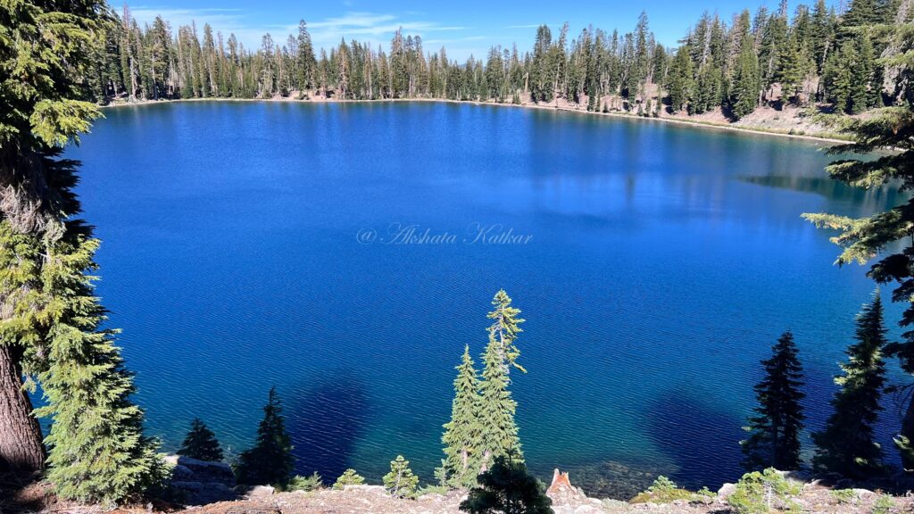
7. Terrace Lake & Shadow Lake Hike
After several shorter scenic stops, we were ready for our first proper hike of the day. We chose the route to Terrace Lake and Shadow Lake. On AllTrails, you can look for the Shadow Lake route and review the current mapped trail before starting.
The trail begins at high elevation and descends from the park highway toward Terrace Lake before continuing to Shadow Lake. One thing worth remembering is that the hike down feels easier—the climbing comes when you return to the trailhead.
If you want a longer version, continue toward Cliff Lake. NPS lists the complete Terrace, Shadow and Cliff Lakes route at approximately 4 miles round trip, while Shadow Lake can be reached with a much shorter outing.
View Shadow Lake Trail on AllTrails →
Official longer route: Terrace, Shadow & Cliff Lakes – NPS
8. Devastated Area Interpretive Trail
After the lake hike, we wanted something easier, so the Devastated Area Interpretive Trail was a great change of pace. This short accessible loop explains what happened during the historic Lassen Peak eruptions of 1914–1917 and how the landscape has recovered over the last century.
Along the trail, interpretive signs, historic photographs, rocks, and surrounding views help tell the story of the eruption. It is an easy stop but adds a lot of context to everything you see elsewhere in the park.
Difficulty: Easy and accessible
Best For: Families, geology, history and an easier walk between longer hikes
Official Information: NPS Devastated Area
Check the Devastated Area trail on AllTrails →
9. Relax at Manzanita Lake
Next came one of our favorite parts of the entire park: Manzanita Lake. Not every stop in a national park needs to involve hiking. Sometimes slowing down and simply enjoying the landscape becomes one of the most memorable parts of the trip.
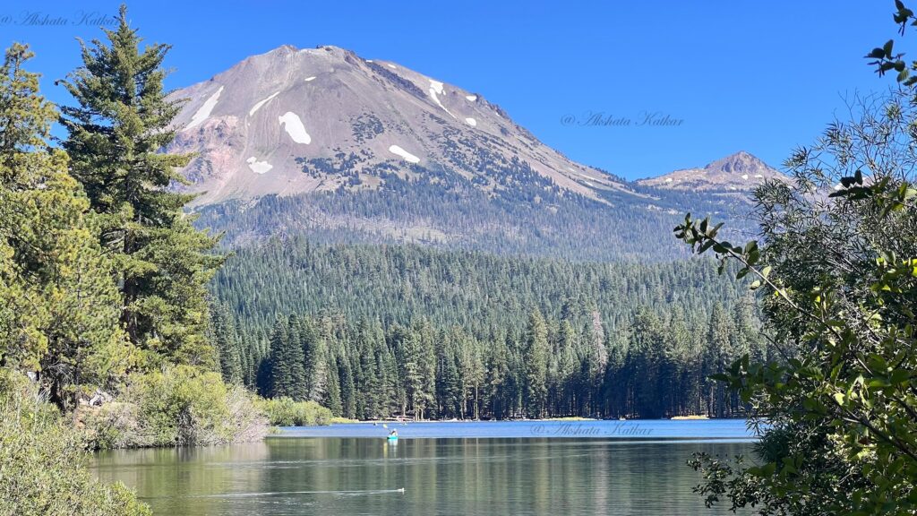
We spread out our picnic mat, had some snacks, and spent time beside the lake. We could see people kayaking and enjoying other non-motorized water activities while Lassen Peak rose behind the surrounding landscape.
If your itinerary is already hike-heavy, Manzanita Lake is the perfect place to deliberately schedule some downtime. It ended up being our favorite relaxing spot in Lassen, which is why we came back again on Day 2.
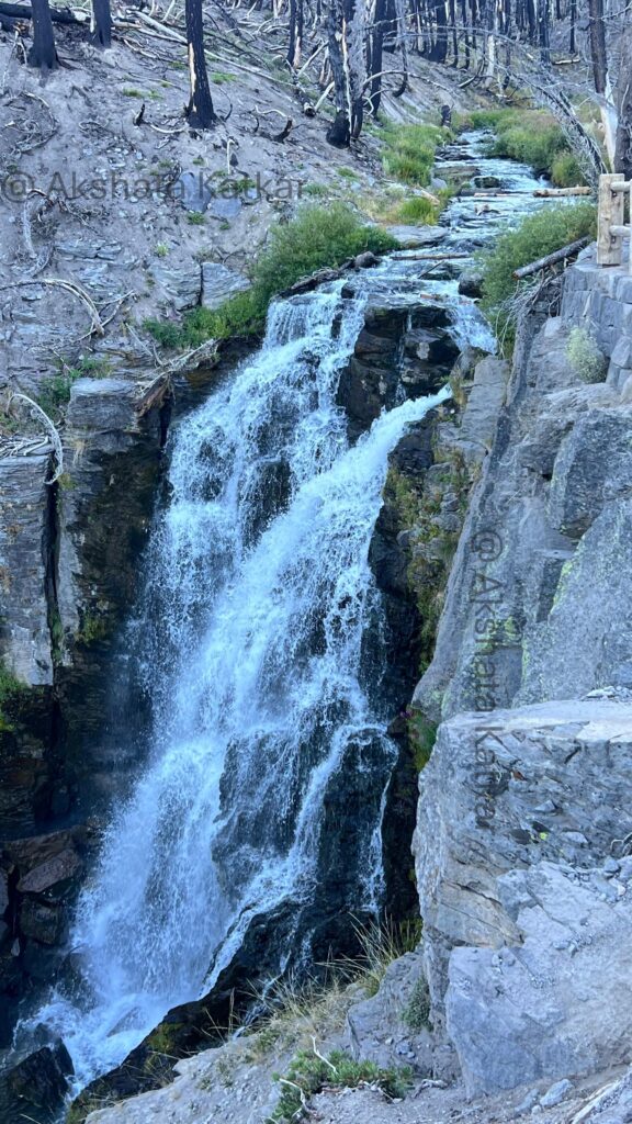
10. Kings Creek Falls – Our Final Hike of Day 1
After resting and refueling with snacks, we decided we still had enough energy for one more hike: Kings Creek Falls. This ended up being a wonderful way to finish our first day.
The trail begins through beautiful meadow scenery before descending toward the waterfall. The main viewpoint overlooks a roughly 30-foot waterfall, and the surrounding cascades make the hike feel scenic well before you reach the final viewpoint.
NPS lists the full loop at about 2.3 miles. Portions include descent, stone steps, and uneven terrain, so it feels more demanding than the distance alone might suggest. Parking is also limited at the trailhead, especially during popular daytime hours.
Distance: Approximately 2.3 miles round trip
Estimated Time: Around 1.5–2 hours depending on pace and stops
Difficulty: Moderate
Highlight: Waterfall, mountain meadow, creek and cascades
Official Information: Kings Creek Falls – NPS
View Kings Creek Falls Trail on AllTrails →
Once we finished Kings Creek Falls, we officially called it a day. While driving toward our hotel, we stopped at one scenic turnout to watch the sky and mountains for a few minutes. It was an unplanned stop, but sometimes those quiet roadside views become some of the best memories from a national park trip.
Day 2: Subway Cave, Manzanita Lake, Summit Lake & Bumpass Hell
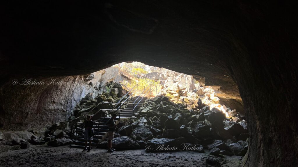
1. Subway Cave – A Lava Tube Near Lassen
Before entering Lassen Volcanic National Park on our second day, we made a stop at Subway Cave near Old Station. Technically, Subway Cave is in Lassen National Forest rather than inside Lassen Volcanic National Park, but I highly recommend adding it to your trip if conditions and timing allow.
Subway Cave is a lava tube created by ancient volcanic activity. The self-guided cave trail takes you underground through a completely dark volcanic passage. The Forest Service lists the cave portion at roughly one-third of a mile, making it a relatively short adventure but one that feels completely different from everything else on this itinerary.
2. Enter Through Lassen’s Northwest Entrance
After Subway Cave, we entered Lassen Volcanic National Park through the Northwest Entrance near Manzanita Lake. And yes—we stopped for another national park sign picture simply because we could!
3. Lassen Peak Vista Point at Manzanita Lake
Soon after entering, we parked safely near the Manzanita Lake area and walked a short distance toward the viewpoint commonly marked as Lassen Peak Vista Point. This is an excellent place to photograph Lassen Peak with Manzanita Lake in the foreground.
When the lake is calm, you may even catch beautiful reflections of Lassen Peak in the water. If you do not have enough time to complete the entire Manzanita Lake loop, this area gives you a wonderful taste of its classic Lassen scenery without requiring a long hike.
4. Loomis Museum
Our next stop was the historic Loomis Museum. I suggest visiting earlier in your day because the museum operates seasonally and has more limited hours than the park itself.
The museum contains exhibits about the park’s natural and volcanic history as well as photographs connected to Benjamin Loomis and the historic Lassen Peak eruptions. It is another useful place to understand the story behind the volcanic landscapes you are seeing during your trip.
Official Information: Loomis Museum – NPS
5. Manzanita Lake – Yes, We Came Back Again
Instead of rushing immediately to the next attraction, we decided to return to Manzanita Lake. It had already become our favorite peaceful spot in the park on Day 1, and one of the best decisions we made during this trip was giving ourselves permission to visit it again rather than trying to check off as many attractions as possible.
If you have extra time, you can also walk the roughly 1.7–1.8 mile Manzanita Lake Loop for changing views of Lassen Peak, Chaos Crags, forest, shoreline and wildlife. Otherwise, simply find a peaceful place near the lake and enjoy it.
6. Summit Lake Loop
From Manzanita Lake we continued south to Summit Lake. Compared with some of Lassen’s more demanding hikes, this was an easy and relaxing stop where we could walk around the lake, enjoy the forested shoreline, and take beautiful photos.
Summit Lake is also a useful starting point for several longer trails, but if you are following a packed two-day itinerary, the shorter lake loop works well between more strenuous hikes.
View Summit Lake Loop on AllTrails →
7. Scenic Meadow & Volcanic Legacy Scenic Byway Views
While continuing along the park highway, we made another quick photo stop near an open meadow with beautiful mountain views, including views toward Reading Peak. Stops like this are one reason driving through Lassen is an experience in itself.
Lassen forms the southern anchor of the Volcanic Legacy Scenic Byway, an All-American Road stretching through volcanic landscapes of Northern California and Southern Oregon. You do not have to complete the entire scenic byway to appreciate it—the stretch through Lassen offers mountain ridges, forests, meadows, lakes, and volcanic features throughout the drive.
8. Bumpass Hell – The Must-Do Lassen Experience
We saved one of Lassen’s biggest attractions for later on Day 2: Bumpass Hell. If the trail is open during your visit, this is one place I would strongly recommend including in your Lassen itinerary.
Bumpass Hell is the largest hydrothermal area in Lassen Volcanic National Park. The hike leads to an extraordinary basin filled with steaming fumaroles, boiling pools, colorful mineral deposits, and bubbling mudpots. Boardwalks take you through the hydrothermal area while keeping visitors safely above the fragile and extremely hot ground.
The standard trail is approximately 3 miles round trip and is generally considered easy to moderate, although the elevation and exposed sections can make it feel more tiring for some hikers. Parking at Bumpass Hell is limited and can fill during busy summer days, so visiting earlier or later in the day may help.
Distance: Approximately 3 miles round trip
Difficulty: Easy to Moderate
Best For: Hydrothermal features and one of Lassen’s most unique landscapes
Official Information: Bumpass Hell Trail – NPS
View Bumpass Hell Trail on AllTrails →
Other Things to Do in Lassen Volcanic National Park
Two days allowed us to experience a lot, but Lassen is much larger than the main park highway. There are several trails and remote areas we did not cover on this particular trip. If you have additional time—or want a more hiking-focused itinerary—consider adding some of these.
Lassen Peak Trail
For experienced hikers looking for a bigger challenge, the Lassen Peak Trail climbs to the summit of the park’s iconic 10,457-foot plug dome volcano. NPS lists the hike at approximately 5 miles round trip with around 2,000 feet of elevation gain, generally requiring 3–5 hours.
The trail is exposed, has limited shade, and high-elevation weather can change quickly. Snow may also persist into summer. This is very different from a casual scenic stop, so prepare appropriately with water, food, sun protection, layers, and proper footwear.
Cinder Cone Trail & Painted Dunes
Another trail high on our list for a future visit is Cinder Cone in the Butte Lake area. The roughly 4-mile round-trip hike begins more gradually before climbing steeply through loose volcanic cinders toward the top of the cone.
From higher points you can see some of Lassen’s most unusual volcanic scenery, including the Fantastic Lava Beds, Painted Dunes, Butte Lake, surrounding peaks, and distant Lassen Peak. The loose sandy volcanic terrain makes the climb significantly harder than its mileage might suggest.
Devils Kitchen
Devils Kitchen is another major hydrothermal area, but unlike roadside Sulphur Works, reaching it requires hiking in the more remote Warner Valley section of the park. The area contains steam vents, bubbling mudpots, boiling pools, and other active geothermal features.
If Bumpass Hell makes you want to explore even more of Lassen’s geothermal landscape, Warner Valley is worth researching for a future trip. Nearby Boiling Springs Lake is another unusual hydrothermal destination in the same general area.
Juniper Lake
Juniper Lake is one of Lassen’s quieter, more remote areas and provides access to additional hikes including Mount Harkness. However, access to remote park areas can change because of seasonal conditions, road maintenance, and recovery work following previous wildfires.
Important for 2026: At the time this blog was written, NPS reported Juniper Lake Road closed to vehicles for repairs related to the 2021 Dixie Fire. Do not build your itinerary around Juniper Lake without first checking the current Lassen park conditions.
What to Pack for Lassen Volcanic National Park
- Plenty of water: Many trailheads and roadside stops do not have drinking water.
- Snacks or picnic food: We loved having snacks ready for our Manzanita Lake break.
- Layers: Elevation changes mean temperatures can feel very different throughout the park.
- Hiking shoes: Especially useful for Kings Creek Falls, Bumpass Hell and longer trails.
- Headlamp or flashlight: Essential if you add Subway Cave.
- Sunscreen and sunglasses: Several higher-elevation trails have exposed sections.
- Downloaded maps: Do not depend on cellular service inside Lassen.
- Portable charger: Navigation, photos and videos can drain your phone quickly.
- Picnic mat: One of our favorite additions for relaxing beside Manzanita Lake.
Important Tips Before Visiting Lassen Volcanic National Park
- Check road and trail conditions before leaving: Snow can affect the park highway and high-elevation hikes much later into the year than you may expect.
- Fill your gas tank before entering: Do not rely completely on seasonal fuel availability inside the park.
- Download your maps in advance: Cell service is limited and unreliable.
- Start popular hikes early or later in the day: Parking at areas such as Bumpass Hell and Kings Creek Falls can fill during peak hours.
- Remember the elevation: Lassen ranges from roughly 5,650 feet to more than 10,000 feet. Give yourself time to adjust and take breaks if needed.
- Never leave boardwalks in hydrothermal areas: Ground that looks solid may hide dangerously hot water, steam, or mud.
- Do not over-plan: Some of our favorite moments came from simply sitting beside Manzanita Lake or stopping at an unexpected scenic turnout.
Is Two Days Enough for Lassen Volcanic National Park?
For a first visit, I think two full days is a very good amount of time for Lassen Volcanic National Park. It gives you enough time to experience the main park highway, several lakes, hydrothermal areas, scenic viewpoints, easier walks, and a few proper hikes without turning the entire trip into a race.
However, hikers who want to summit Lassen Peak, climb Cinder Cone, explore Warner Valley, spend significant time in Butte Lake, or visit the park’s remote sections could easily use three or four days.
Our Favorite Places in Lassen Volcanic National Park
It is difficult to pick only a few favorites because every stop was so different, but Manzanita Lake was easily our favorite place to slow down and relax. We liked it enough to visit on both days. Bumpass Hell was the most unique volcanic experience, Lake Helen was one of our favorite photo stops, and Kings Creek Falls was a rewarding way to finish our first day of hiking.
I would also make time for Subway Cave if you are entering from the northwest side. Walking through a dark lava tube before spending the rest of the day among volcanoes and hydrothermal areas makes the geology of this entire region feel even more real.
Final Thoughts on Our 2-Day Lassen Volcanic National Park Itinerary
Lassen Volcanic National Park feels very different from many of California’s better-known national parks. Within two days, we experienced steaming hydrothermal features, volcanic landscapes, waterfalls, alpine lakes, forests, mountain views, a lava tube cave, scenic drives, and peaceful picnic stops.
What I loved most about our itinerary was the balance. We did not spend both days doing strenuous hikes, but we also did much more than simply drive from viewpoint to viewpoint. We mixed moderate hikes such as Kings Creek Falls and Bumpass Hell with easier walks, lake stops, photography, a museum visit, and plenty of time to actually enjoy Manzanita Lake.
If you are planning your first Lassen trip from the Bay Area, I hope this two-day route gives you a realistic starting point. Adjust it based on your hiking ability, seasonal trail conditions, and how much time you want to spend at each lake or viewpoint.
One last planning tip before you go:
Download the trails you plan to hike before arriving in Lassen. With limited cellular service, having offline trail maps available can make hiking and navigation much easier.
Trail distances, opening dates, road conditions, operating hours, access rules, and services can change. Always check the official National Park Service website and current trail conditions before beginning your trip or hike.
Read More Travel Blogs
If you enjoyed this Lassen Volcanic National Park itinerary, explore more of my travel blogs for weekend getaways, road trip ideas, itineraries, and memorable experiences from California and beyond.